Convert GeoJSON to DWG online
Drop the GeoJSON in the converter below, check it on the map, and download a DWG (AutoCAD R2000) and a DXF in metres. Longitude/latitude are projected to the UTM zone of your data, or to the EPSG code you type, and the property you pick names the CAD layers. The conversion is free up to 50 MB, with no account.
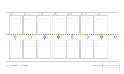


No file at hand? See an example plan read by Max AI · Got a DWG or DXF too? Max AI reads its title block, finds its symbols and cleans it.
Why convert GeoJSON to DWG here?
- Longitude/latitude projected to UTM metres (or the EPSG you type): lengths and areas measure right in AutoCAD.
- Pick the property that names the CAD layers (e.g.
type): one layer per value. - DWG R2000 plus a DXF in the same download: one of them opens in any CAD software.
- Points with a
textproperty become CAD texts (a DWG converted here comes back with its texts); lines and polygons become polylines.
How it works
- UploadDrop your file, up to 50 MB. Nothing to install, no account.
- See it on the mapEvery layer drawn on a map in a minute or two. Click an object to see its attributes.
- Place & checkCoordinate system from the file, from the coordinate labels, by search or with 2 points. You check it on the map and adjust it by hand.
- DownloadFree. For CAD drawings, Max AI reads the title block, finds the symbols and cleans the plan: $10, only if you like what it shows you.
Free conversion. Max AI: $10 per drawing, only if you like its result — 30-day money-back guarantee.
Technical details
| Input | GeoJSON (.geojson or .json, a FeatureCollection, from QGIS, geojson.io, Overpass, web APIs) |
|---|---|
| Output | DWG R2000 and DXF, in metres, one layer per value of the property you pick |
| Max size | 50 MB |
| Coordinate systems | 8,000+ EPSG codes: UTM, State Plane, Lambert, Merchich, OSGB, RGF93… |
Going the other way? Convert DWG to GeoJSON.
Pricing — no subscription
Free conversion. Max AI: $10 per drawing, only if you like its result — 30-day money-back guarantee.
| Conversion | Free | Map preview, layer categories, altitudes linked, placement on the map, and the download: Shapefile + KMZ from CAD, DXF or DWG from GIS, and Shapefile / KML / KMZ / GeoJSON / CSV / GPX between them. Any file up to 50 MB, 5 files and 3 downloads a day |
|---|---|---|
| Max AI export | $10 | Per drawing, CAD → GIS: the title block read (plan_info.txt), symbols found (manholes, valves…) and the plan cleanup, in your zip |
FAQ
How do I convert GeoJSON to DWG?
Drop the .geojson above, check it on the map, keep "Also a DWG" ticked, then download. The zip holds drawing.dwg and drawing.dxf.
Why is my GeoJSON tiny when I import it into AutoCAD?
GeoJSON stores degrees, AutoCAD expects metres or feet. We project it first, so a 100 m road is 100 units long.
Can I match the coordinate system of my survey?
Yes: type its EPSG code (a State Plane, UTM or national grid) before downloading, and the drawing is written in it.
How much does GeoJSON to DWG cost?
Nothing: the map preview and the download are free, any file up to 50 MB, 3 downloads a day.
What happens to my files?
Your files are deleted after 24 hours and never used for AI training. They are only used to make your conversion.
Can I get a refund?
Yes: 30-day money-back guarantee, no questions asked. E-mail us and you get your money back in full.
Are there limits on free conversions?
Free: 5 files and 3 downloads a day per visitor, files up to 50 MB. We ask your e-mail once, before your first download or Max AI run, and send a link to confirm it; this browser then remembers it. Once you start Max AI on a drawing, its $10 export is the download for that drawing.
How do I pay?
The conversion is free. Only the Max AI export is paid: $10 per drawing, by card through Paddle, our reseller. No subscription.