DWG layer mapping to GIS categories, with AI
Drop the DWG below: every CAD layer is sorted into a GIS category (roads, sewer, storm, water, electric, telecom, parcels, buildings, topography, annotation) by its name, for free, and you can change any of them. Max AI then names the layers the rules leave as Other, like RES_EU_P or L-04-EXIST, and reads the altitude labels. You see the result on your map before you pay anything; the Max AI export is $10 per drawing.
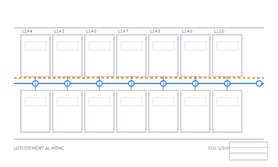


No file at hand? See an example plan read by Max AI
What you get
- Rules first, freeLayer names like
ASSAINISSEMENT,EP,ROAD_EDGEare sorted by keywords in English and French. One dropdown per layer to correct it. - Max AI for the restThe layers the rules leave as Other are read all together, with their object counts, the way a person would decode them, and given a category. You apply it or not.
- Altitudes understoodLabels like
TN 125.30orRad. 123.10are linked to the nearest point and their meaning read:z_ground,z_invert… - In your GISThe category goes into a
categorycolumn of the Shapefile and a folder of the KMZ, next to the originallayer.
See it on a real plan: an example plan read by Max AI. Everything it does: Max AI.
How it goes
- Drop your drawingThe conversion and the map preview are free.
- Start Max AISay what you need from the plan (networks, parcels, roads…) and start it. Free to run: once per file, 3 drawings a day.
- Check it on your mapLook at what it read and found. Apply what you want, undo the rest.
- ExportHappy with it? Export with Max AI, $10. Not happy after paying? Money back within 30 days.
Free conversion. Max AI: $10 per drawing, only if you like its result — 30-day money-back guarantee.
Pricing — no subscription
Free conversion. Max AI: $10 per drawing, only if you like its result — 30-day money-back guarantee.
| Conversion | Free | Map preview, layer categories, altitudes linked, placement on the map, and the download: Shapefile + KMZ from CAD, DXF or DWG from GIS, and Shapefile / KML / KMZ / GeoJSON / CSV / GPX between them. Any file up to 50 MB, 5 files and 3 downloads a day |
|---|---|---|
| Max AI export | $10 | Per drawing, CAD → GIS: the title block read (plan_info.txt), symbols found (manholes, valves…) and the plan cleanup, in your zip |
FAQ
What is DWG layer mapping?
Matching each CAD layer of a drawing to what it means in GIS (a sewer pipe, a parcel, a road edge), so the data can be filtered, styled and loaded into a GIS database.
Which categories are layers mapped to?
Roads, Sewer, Storm, Water, Electric, Telecom, Parcels, Buildings, Topography, Annotation and Other. You can change any layer's category before downloading.
Why use AI for layer names?
Layer names are free text: abbreviations, L-04-EXIST, a surveyor's own codes, mixed languages. Rules catch the usual keywords; Max AI reads all the names together to decode the rest.
Does the AI change my geometry?
No. Max AI only proposes a category per layer; the objects, their coordinates and their CAD layer stay as drawn.
What happens to my files?
Your files are deleted after 24 hours and never used for AI training. They are only used to make your conversion.
Can I get a refund?
Yes: 30-day money-back guarantee, no questions asked. E-mail us and you get your money back in full.
Are there limits on free conversions?
Free: 5 files and 3 downloads a day per visitor, files up to 50 MB. We ask your e-mail once, before your first download or Max AI run, and send a link to confirm it; this browser then remembers it. Once you start Max AI on a drawing, its $10 export is the download for that drawing.
How do I pay?
The conversion is free. Only the Max AI export is paid: $10 per drawing, by card through Paddle, our reseller. No subscription.