Convert CAD to GIS and back — see it on a map first

DWG and DXF to Shapefile, KML and KMZ. Shapefile, KML and KMZ to DXF and DWG. GeoJSON, GPX and CSV too. Layers, attributes and projection kept.
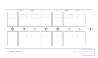
No file at hand? See an example plan read by Max AI

Converters

DWG → ShapefileUpload a DWG, check it on the map, download a Shapefile that opens in QGIS and ArcGIS at the right place.Shapefile → DWGUpload a zipped Shapefile, check it on the map, download a DXF or DWG that opens in AutoCAD with real layers.DWG → KMLUpload a DWG, place it on the map, download a KMZ that lands at the right place in Google Earth.KML → DWGUpload a KML or KMZ, check it on the map, download a DWG or DXF in metres, ready for AutoCAD.DXF → KMZUpload a DXF, place it on the map, download a KMZ for Google Earth.KMZ → DXFUpload a KMZ, check it on the map, download a DXF in metres.KMZ → ShapefileUpload a KMZ, check it on the map, download a Shapefile that opens in QGIS and ArcGIS at the right place.KML → ShapefileUpload a KML, check it on the map, download a Shapefile ready for QGIS and ArcGIS.Shapefile → KMZUpload a zipped Shapefile, check it on the map, download a KMZ that lands at the right place in Google Earth.Shapefile → KMLUpload a zipped Shapefile, check it on the map, download a KML for Google Earth or Google My Maps.DWG → KMZUpload a DWG, check where it lands on the map, download a KMZ that opens in Google Earth.KMZ → DWGUpload a KMZ, check it on the map, download a DWG that opens in AutoCAD at real size.DXF → KMLUpload a DXF, place it on the map, download it for Google Earth.KML → DXFUpload a KML, check it on the map, download a DXF in metres.DXF → ShapefileUpload a DXF, check it on the map, download a Shapefile for QGIS or ArcGIS.Shapefile → DXFUpload a zipped Shapefile, check it on the map, download a DXF for any CAD software.GeoJSON → ShapefileUpload a GeoJSON, check it on the map, download a Shapefile for QGIS, ArcGIS or any desktop GIS.Shapefile → GeoJSONUpload a zipped Shapefile, check it on the map, download a GeoJSON for Leaflet, Mapbox or geojson.io.GeoJSON → KMLUpload a GeoJSON, check it on the map, download a KML for Google Earth or Google My Maps.KML → GeoJSONUpload a KML or KMZ, check it on the map, download a GeoJSON for your web map or code.DWG → GeoJSONUpload a DWG, place it on the map, download a GeoJSON for Leaflet, MapLibre, PostGIS or Python.GeoJSON → DWGUpload a GeoJSON, check it on the map, download a DWG and a DXF in metres for AutoCAD.KML → CSVUpload a KML or KMZ, check it on the map, download a CSV table for Excel or Google Sheets.KML → GPXUpload a KML or KMZ, check it on the map, download a GPX for your GPS, Garmin or phone app.GPX → KMLUpload a GPX, check it on the map, download a KML for Google Earth or Google My Maps.GPX → ShapefileUpload a GPX, check it on the map, download a Shapefile for QGIS or ArcGIS.GeoJSON → CSVUpload a GeoJSON, check it on the map, download a CSV table for Excel, Google Sheets or pandas.

More than a conversion: Max AI

How it works

  1. UploadDrop your file, up to 50 MB. Nothing to install, no account.
  2. See it on the mapEvery layer drawn on a map in a minute or two. Click an object to see its attributes.
  3. Place & checkCoordinate system from the file, from the coordinate labels, by search or with 2 points. You check it on the map and adjust it by hand.
  4. DownloadFree. For CAD drawings, Max AI reads the title block, finds the symbols and cleans the plan: $10, only if you like what it shows you.

Free conversion. Max AI: $10 per drawing, only if you like its result — 30-day money-back guarantee.

Pricing — no subscription

Free conversion. Max AI: $10 per drawing, only if you like its result — 30-day money-back guarantee.

ConversionFreeMap preview, layer categories, altitudes linked, placement on the map, and the download: Shapefile + KMZ from CAD, DXF or DWG from GIS, and Shapefile / KML / KMZ / GeoJSON / CSV / GPX between them. Any file up to 50 MB, 5 files and 3 downloads a day
Max AI export$10Per drawing, CAD → GIS: the title block read (plan_info.txt), symbols found (manholes, valves…) and the plan cleanup, in your zip

FAQ

What happens to my files?

Your files are deleted after 24 hours and never used for AI training. They are only used to make your conversion.

Can I get a refund?

Yes: 30-day money-back guarantee, no questions asked. E-mail us and you get your money back in full.

Are there limits on free conversions?

Free: 5 files and 3 downloads a day per visitor, files up to 50 MB. We ask your e-mail once, before your first download or Max AI run, and send a link to confirm it; this browser then remembers it. Once you start Max AI on a drawing, its $10 export is the download for that drawing.

How do I pay?

The conversion is free. Only the Max AI export is paid: $10 per drawing, by card through Paddle, our reseller. No subscription.